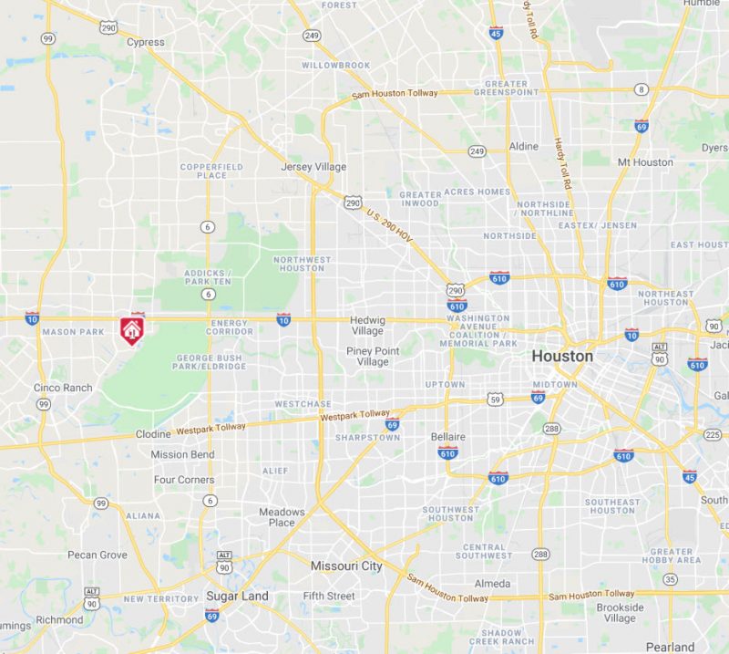
Katy Commute Times and Traffic
Katy is so large that commute times may vary drastically depending on where you live in Katy…and where you are commuting. You can use Google Maps to estimate drive times from various locations.
Katy has two park and ride locations if you are commuting to Houston:
- 21669 Kingsland Blvd
- 1030 W Grand Parkway
Visit www.ridemetro.org for more information about other options such as ride matching, ride sharing, METRO lift, and the HOV system.
Highway Nicknames
Katy Freeway = I-10
Grand Parkway = Hwy 99
Westpark Tollway = FM 1093
The Loop = I-610
Southwest Frwy = I-59/I-69
Northwest Frwy = Hwy 290
Commute Times
The following tables shows the estimated commute times from Katy to important places of interest. Times vary depending on route, traffic, wrecks, etc.
|
Place |
Miles Away |
Peak |
Off-Peak |
|
George Bush Intercontinental Airport |
44 |
55 mins |
44 mins |
|
Hobby Airport |
38 |
54 mins |
43 mins |
|
Texas Medical Center |
28 |
46 mins |
35 mins |
|
Downtown Houston |
30 |
42 mins |
32 mins |
|
Galleria |
23 |
38 mins |
26 mins |
|
Energy Corridor |
13 |
22 mins |
17 mins |
|
Kemah |
61 |
1 hr |
55 mins |
|
NASA |
55 |
62 mins |
50 mins |
|
Galveston |
79 |
1 hr 30 mins |
1 hr 20 mins |
*Peak Travel Time is general 7-9 a.m. and 4-6 p.m. Travel routes vary. LaCenterra address was used as the starting point.
The best way to estimate your commute time is to use Google Maps at the time you commute. Simply enter your work address and the address of the house you are interested in, and Google Maps will estimate your commute time. This time is based on the actual time you perform the search, so use it during your expected commute times.
